Atlas of Italy

From Wikimedia Commons, the free media repository
Jump to navigation Jump to search
Internet-web-browser.svg Wikimedia Commons Atlas of the World

The Wikimedia Atlas of the World is an organized and commented collection of geographical, political and historical maps available at Wikimedia Commons.
Discussion • Update the atlas • Index of the Atlas • Atlas in categories • Other atlases on line
Commons-logo.svg
The introductions of the country, dependency and region entries are in the native languages and in English. The other introductions are in English.
 
EU-Italy.svg
Italy

Flag of Italy.svg

Italia

Italiano Italia - Repubblica Italiana

La Repubblica Italiana è uno stato dell'Europa meridionale, che occupa gran parte della regione geografica italiana (o italica). L'Italia viene tradizionalmente chiamata la Penisola (in ragione della sua natura geografica prevalente) e lo Stivale (in virtù della sua caratteristica forma). La Repubblica Italiana, avente come capitale la città di Roma, confina con la Francia a ovest, con la Svizzera e l'Austria a nord e con la Slovenia a est; al suo interno sono presenti due microstati: San Marino e la Città del Vaticano. Fa parte della Repubblica anche l'exclave di Campione d'Italia, comune nel territorio della Svizzera italiana.

Deutsch Italien - Italienische Republik

Die Italienische Republik ist eine Republik in Europa, die zum größten Teil auf einer vom Mittelmeer umschlossenen Halbinsel liegt. Italiens Hauptstadt ist Rom. Angrenzende Staaten sind Frankreich (488 km), die Schweiz (734,2 km), Österreich (430 km), Slowenien (232 km), sowie Kroatien (über eine Seegrenze), die Enklaven San Marino (39 km) und die Vatikanstadt (in Rom, 3 km). Zu Italien gehören die Mittelmeer-Inseln Sizilien, Sardinien und Elba.

Français Italie - République Italienne

La République Italienne est un pays d'Europe méridionale. Située au centre de la mer Méditerranée, elle est isolée du reste du continent par le massif des Alpes. L'apport de l'Italie à la civilisation occidentale est immense : elle est notamment le berceau de l'Empire romain et de la Renaissance italienne. Existant en tant qu'État depuis la Réunification (1861), elle est aujourd'hui une démocratie parlementaire solide, membre fondateur de l'Union européenne.

English Italy - Italian Republic

The Italian Republic is a country located in Southern Europe, that comprises the Po River valley, the Italian Peninsula and the two largest islands in the Mediterranean Sea, Sicily and Sardinia, situated south of Calabria and southwest of Italy, respectively. It is also called by Italians lo Stivale ("the Boot", due to its boot-like shape), or la Penisola ("the Peninsula" as an antonomasia). Italy has five autonomous regions: ► Aosta Valley, ► Friuli-Venezia Giulia, ► Sardinia, ► Sicily and ► Trentino-Alto Adige. Italy shares its northern alpine boundary with ► France, ► Switzerland, ► Austria and ► Slovenia. The independent countries of ► San Marino and the ► Vatican City are enclaves within Italian territory, while Campione d'Italia is an Italian exclave in Switzerland. South of Italy the island nation of ► Malta is located. The names in other (regional) languages are:

  • Calabrian: Itaglia - Repubblica (i)Tagliana
  • Emilian-Romagnol: Itâglia
  • Friulian: Italie
  • German: Italien
  • Ligurian: Italia
  • Lombard: Itàlia - Repüblica Italiana
  • Neapolitan: Italia
  • Piedmontese: Italia
  • Sardinian: Itàlia
  • Sicilian: Tàlia - Ripùbblica di Tàlia
  • Slovenian: Italija - Italijanska republika
  • Venetian: Itałia - Republica Tałiana

Short name  Italy
Official name Italian Republic
Status Independent country, united since 1861, member of the ► European Union since 1957
Location South Europe
Capital Roma (Rome)
Population 60,317,116 inhabitants
Area 301,340 km²
Languages Italian (official), twelve linguistic minorities, other languages
Religions Roman Catholicism
More information Italy, Geography of Italy, History of Italy and Politics of Italy
More images Italy - Italy (Category).

General maps

It-map.png Map of Italy (CIA WFB)
It-map.jpg Map of Italy
Italy map-blank.svg Blank map of Italy (with shaded relief)
Europe location ITA.png Location within Europe
EU location ITA.png Location within European Union
Italy topographic map-blank.svg Blank topographic map of Italy
Italy.geohive.gif Administrative divisions of Italy
Regioni of Italy with official names.png Regions of Italy
Map of Italy blank.svg Provinces of Italy

Municipalities of Italy

Bay-of-Piran maritime-boundary-dispute.jpg

History maps

This section holds a short summary of the history of the area of present-day Italy, illustrated with maps, including historical maps of former countries and empires that included present-day Italy.

Pre-Roman period

Cultures, 1200 BC.PNG The Terramare culture (or "Terramara culture") is a Bronze Age archaeological culture of Italy and Dalmatia, dating to ca. 1500-1100 BC. It takes its name from the "black earth" (terremare) residue of settlement mounds.
Italy-Villanovan-Culture-900BC.png The Villanovan culture, the oldest phase of the Etruscan civilization, was one of the earliest Iron Age culture of central and northern Italy, abruptly following the Proto-Villanovan culture and giving way in the 7th century BC to an increasingly orientalizing culture influenced by Greek traders. The Villanovans introduced iron-working to the Italian peninsula; they practiced cremation and buried the ashes of their dead in pottery urns of distinctive double-cone shape. Villanovan culture is broadly divided into a Villanovan I from 900 BC to 800 BC and the Villanovan II from 800 BC to 720 BC. This map shows the Villanovan culture around 900 BC.
Etruscan civilization map.png
At the end of the bronze age, the most important civilization was the Etruscan civilization,[1] or in Etruscan Rasenna. As distinguished by its own language, the civilization endured from c. 900 BC to the foundation of Rome until its complete assimilation to Italic Rome in the Roman Republic. At its maximum extent during the foundation period of Rome and the Roman kingdom, it flourished in three confederacies: of Etruria, of the Po valley with the eastern Alps, and of Latium and Campania. Rome was sited in Etruscan territory. There is considerable evidence that early Rome was dominated by Etruscans until the Romans sacked Veii in 396 BC. The preceding Iron Age Villanovan culture gave way in the seventh century to a culture that was influenced by Greek traders and Greek neighbors in Magna Graecia, the Hellenic civilization of southern Italy.

The Etruscans are believed to have spoken a non-Indo-European language. Knowledge of their language is still far from complete. The mining and commerce of metal, especially copper and iron, led to an enrichment of the Etruscans and to the expansion of their influence in the Italian peninsula and the western Mediterranean sea. Here their interests collided with those of the Greeks, especially in the sixth century BCE, when Phoceans of Italy founded colonies along the coast of France, Catalonia and Corsica. This led the Etruscans to ally themselves with the Carthaginians, whose interests also collided with the Greeks.

Around 540 BC, the Battle of Alalia led to a new distribution of power in the western Mediterranean Sea. Though the battle had no clear winner, Carthage managed to expand its sphere of influence at the expense of both the Etruscans and the Greeks, and Etruria saw itself relegated to the northern Tyrrhenian Sea.

Since the first half of the fifth century, the new international political situation meant the beginning of the Etruscan decline. In 480 BCE, Etruria's ally Carthage was defeated by a coalition of Magna Graecia cities led by Syracuse. A few years later, in 474, Syracuse's tyrant Hiero defeated the Etruscans at the Battle of Cumae. Etruria's influence over the cities in the Latium and Campania weakened, and it was taken over by Romans and Samnites. In the fourth century, Etruria saw a Gallic invasion end its influence over the Po valley and the Adriatic coast. Meanwhile, Rome had started annexing Etruscan cities. At the beginning of the 1st century BCE, Rome annexed all the Etruscan territory.

Other tribes in Italy include:

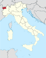
  • In the north, the Ligures or Ligurians, an ancient people who gave their name to Liguria, which once stretched from Northern Italy into southern Gaul. The Ligures inhabited what now corresponds to Liguria, northern Tuscany, Piedmont, part of Emilia-Romagna, part of Lombardy, and parts of southeastern France. It is not known for certain whether they were a pre-Indo-European people akin to Iberians; a separate Indo-European branch with Italic and Celtic affinities; or even a branch of the Celts. Kinship between the Ligures and Lepontii has also been proposed. Another theory traces their origin to Betica (modern Andalusia). See for the spread of Celtic culture the two maps of Central Europe.
  • More to the north, the Lepontii: The Lepontii were an ancient people occupying portions of Rhaetia (in modern Switzerland and Italy) in the Alps during the time of the Roman conquest of that territory. The Lepontii have been variously described as a Celtic, Ligurian, Raetian, and Germanic tribe. However, most evidence, including recent archeological excavations, and their association with the 'Golasecca culture' of Northern Italy, indicates a Celtic origin although they might actually be an amalgamation of Raetians (who were of Etruscan origin) and Celts.
  • To the north-east: The Veneti were an ancient people who inhabited north-eastern Italy, in an area corresponding to the modern-day region of the Veneto. They spoke Venetic, an independent Indo-European language, which is attested in approximately 300 short inscriptions dating from 6th to 1st centuries BC. Venetic appears to share several similarities with Latin and the Italic languages, but also has some affinities with other IE languages, especially Germanic as well as Celtic.
  • In the centre: The Latins were an ancient Italic people who migrated to central Italy, in the 2nd millennium B.C., maybe from the Adriatic East Coast and Balcanic Area, perhaps from pressures by Illyrian peoples. Although they lived in independent city-states, the Latins had a common language (Latin), common religious beliefs and a close sense of kinship, expressed in the myth that they were all descendants of Latinus, the father-in-law of Aeneas. The Latin cities extended common right to residence and trade to one another. One of these states was Rome.
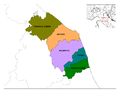
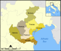
  • To the east: The Umbri are one of the oldest races of indigenous people in Italy. Most Umbrian cities were settled in the 9th - 4th centuries BC and were located on easily defendable hilltops. The region of Umbria is the land bordered by the Tiber and Nar rivers and the area covered by the Appennine slopes on the Adriatic. The Umbrian language is part of a group called Oscan-Umbrian which is related to Latin.
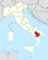
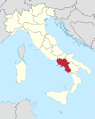
  • More to the south: the Osci, were historic inhabitants of Southern Italy dwelling in Northern Campania and ultimately settling in the border region between Latium and Campania. They also competed with the Etruscans for possession over Campania. Later in the 5th century, the Samnites (Samnium), a warlike people who also spoke Oscan, took over the Oscan region and subjugated the Osci.
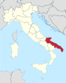
  • To the south-east: The Messapii were an ancient tribe that inhabited the south-eastern peninsula or "heel" of Italy. They spoke the Messapian language. They are often referred to as "the most southerly of the Iapygian tribes".
  • Finally the south was populated by ► Greeks. The region was named Magna Graecia.
Iron Age Italy.png
Celts 800-400BC.PNG
Distribution of Celts in Europe.png
Location greek ancient.png
Magna Graecia.jpg
Italie -400.JPG Italy around 400 BCE;
  Celts
  Etrurians
  Umbrians
  Italians various
  Romans
  Samnites
  :fr:Messapes and Apulians
  Greeks
  Carthagians

Roman period

SPQRomani.svg 753 BC-395: Roman Empire - includes present-day Italy ► Roman Empire

RomanKingdom.png
The small Italian state of the Roman Kingdom 753-510 BCE develops after 510 in the Roman Empire. The second map shows the territorial development of the Roman Empire, that at it height controls most of Southern and Western Europe, North Africa and West Asia.
Roman Empire map-2.gif
Invasions of the Roman Empire 1.png After 100 Germanic tribes gradually enter the area of the Roman Empire. This map shows invasions of the Roman Empire 100-500.

Italy after the division of the Roman Empire

SPQRomani.svg 395-486: Western Roman Empire - includes present-day Italy ► Roman Empire

Extent of Western Roman Empire 395.png In 395 the Roman Empire falls apart into the Western Roman Empire and the ► Eastern Roman Empire.
EasternRomanEmpire.png Eastern Roman Empire
Justinien 527-565.svg Eastern Roman Empire around 550
Justinian Byzanz.png Eastern Roman Empire or Byzantine Empire around 550
Byzantium550.png Byzantine Empire 550
ByzantineEmpire717AD.png The Byzantine Empire at the accession of Leo III, c. 717
Odoacer 480ad.jpg Italy under King Odoacer, the deposer of the last Emperor.
Ostrogothic Kingdom.png The Ostrogothic Kingdom
Mappa italia bizantina e longobarda.jpg Italy around 750

Frankish rule

Frankish empire.jpg Rise of the Frankish Empire
Frankenreich 768-811.jpg The Frankish Empire
Carolingian Empire map 1895.jpg Carolingian Empire around 800
Empire carolingien.png Carolingian Empire (in French)
Karte kirchenstaat.jpg Papal States around 800
Europe 814.jpg Europe in 814
843-870 Europe.jpg Treaty of Verdun (843) and Treaty of Meerssen (870)
Western Empire-Europe870.JPG Division of the Frankish Empire after 870

Divided Italy

Viking expansion.png Map showing Scandinavian settlement in the eighth (dark red), ninth (red), tenth (orange) and eleventh (yellow) centuries. Areas denoted in green are those affected by frequent viking incursions but with little or no Scandinavian settlement.
ByzantineEmpire867AD3.PNG South Italy as part of the Byzantine Empire at the accession of Basil I, c. 867
Italy 1000 AD.svg Italy 1000
Republik Venedig.png Republic of Venice c. 1000
Aragonese Empire.PNG Aragonese Empire
Byzantium1025.jpg South Italy as part of the Byzantine Empire under Basil II, c. 1025
Map Byzantine Empire 1025-fr.svg South Italy as part of the Byzantine Empire 1025
Italy 1050.jpg Italy around 1050
HRR 14Jh.jpg The Holy Roman Empire in the 14th century
Italy 1494 v2.png Italy in early 1494, before the invasion of Charles VIII of France
Italy 1494 shepherd.jpg Italy around 1494
Charles I and V empire.png The (Habsburg) Empire of Charles I/V.
  Castile
  Aragon
  Burgundy
  Habsburg
Habsburg Map 1547.jpg The (Habsburg) Empire of Charles I/V
Spain1580.gif Area ruled by the Spanish king around 1580 on a map showing modern-day state borders
Italy 1796.png A political map of Italy in 1796.
Italy northern 1796.jpg Northern Italy in 1796
Republic of Venice 1796.png Republic of Venice in 1796
Italy 1803.jpg Northern Italy in 1803
1807KingdomItaly.jpg Kingdom of Italy in 1807
Italy c 1810.png A political map of Italy in 1810.
1french-empire1811.jpg French Empire 1811
Europe map Napoleon 1811.png Europe under Napoleon
Italie 1812.png French Departments in Italy in 1812
Italia1815.jpg Italy in 1815
Suddivisione amministrativa del Regno delle Due Sicilie.png Kingdom of the Two Sicilies

Process of unification

Unification of Italy 1815-1870.jpg Italian unification 1815-1870
Italia1859.png After the collapse of the French rule and the Congress of Vienna, Italy is divided in several independent countries. This map shows the countries in 1859 before the unification (Kingdom of Sardinia, Papal States, Kingdom of the Two Sicilies, Grand Duchy of Tuscany with the duchies of Parma and Modena (green), the Lombard-Venetian Kingdom. The main of these countries was Sardinia. That kingdom was restored in 1814 and enlarged with the addition of the former Republic of Genoa. In 1850 a liberal ministry under Count Camillo Benso di Cavour was installed, and the Kingdom of Sardinia became the engine driving the Italian Unification.
Italia1860.png In 1859 Sardinia conquered Lombardy. In 1860 Parma, Tuscany, Modena and Romagna voted in referenda to join the Kingdom of Sardinia. The same year it acquired the Kingdom of the Two Sicilies. In 1861 the Kingdom of Italy was proclaimed thus ending the Kingdom of Sardinia as a separate kingdom.

United Italy

RegnoItalia1861.png Kingdom of Italy in 1861
RegnoItalia1866.png Kingdom of Italy in 1866
RegnoItalia1870.png Kingdom of Italy in 1870
Kingdom of Italy 1919 map.svg Kingdom of Italy in 1919
Kingdom of Italy 1924 map.svg Kingdom of Italy in 1924, before WWII
Italian empire 1940.svg Italian colonial empire around 1940
Invasionofitaly1943.jpg Invasion in Italy 1943
ItalyDefenseLinesSouthofRome1943 4.jpg Germans defense lines in 1943
Italian social republic map.png Italian Social Republic in 1943
Free Territory of Trieste Map.svg Free Territory of Trieste 1947-1954
Treaty of Osimo map.png Partition of the FTT according to the Treaty of Osimo (1975)

Old maps

This section holds copies of original general maps more than 70 years old.

Dep-fr-it.jpg Napoleonic departments in Northern Italy
TannerMapKingdomSardinia1839.jpg Map of the Kingdom of Sardinia in 1839
Italien 1905.png Italy in 1905

Ethno-linguistic maps

Linguistic map of Italy - Legend.svg Languages of Italy
Minoranze linguistiche it.svg Historical linguistic minorities of Italy
Walser Italien.JPG German settlements in Piedmont and Aosta Valley
Italia demographics 1859.jpg Old demographic map of Italy
BiasuttiMappa.png Presence of Blondism in Italy
Anthropological maps of Italy.png Pigmentation eyes & hair and height

Satellite maps

Satellite image of Italy in March 2003.jpg Satellite map

Notes and references

General remarks:

  • The WIKIMEDIA COMMONS Atlas of the World is an organized and commented collection of geographical, political and historical maps available at Wikimedia Commons. The main page is therefore the portal to maps and cartography on Wikimedia. That page contains links to entries by country, continent and by topic as well as general notes and references.
  • Every entry has an introduction section in English. If other languages are native and/or official in an entity, introductions in other languages are added in separate sections. The text of the introduction(s) is based on the content of the Wikipedia encyclopedia. For sources of the introduction see therefore the Wikipedia entries linked to. The same goes for the texts in the history sections.
  • Historical maps are included in the continent, country and dependency entries.
  • The status of various entities is disputed. See the content for the entities concerned.
  • The maps of former countries that are more or less continued by a present-day country or had a territory included in only one or two countries are included in the atlas of the present-day country. For example the Ottoman Empire can be found in the Atlas of Turkey.
  1. See also Etruscan history

Entries available in the atlas

General pages
Atlas • Historical atlas • Index of the Atlas • Names in native languages

The world and its continents and oceans
Quick reference • Historical maps of the world • Old maps
Physical and topographical • Political • Geological • People • Time and time zones • Projections of the globe
Africa • North and South America • Antarctica • Asia • Europe

(History, European Union) • Oceania • Oceans

Themes
Administrative divisions • International organizations • Languages • Religions

Historical eras
Prehistory • Antiquity • Middle Ages • Rise of Islam • Early Modern Age • Early American Societies • Early Asian Societies • Age of Renaissance • Colonialism • Stielers Handatlas 1891 • 20th Century • World War I • World War II

Entities with undisputed sovereign status
Afghanistan • Albania • Algeria • Andorra • Angola • Antigua and Barbuda • Argentina • Armenia • Australia • Austria • Azerbaijan • Bahamas • Bahrain • Bangladesh • Barbados • Belarus • Belgium • Belize • Benin • Bhutan • Bolivia • Bosnia and Herzegovina • Botswana • Brazil • Brunei • Bulgaria • Burkina Faso • Burundi • Cambodia • Cameroon • Canada • Cape Verde • Central African Republic • Chad • Chile • China • Colombia • Comoros • Congo (Democratic Republic) • Congo (Republic) • Costa Rica • Côte d’Ivoire • Croatia • Cuba • Cyprus • Czech Republic • Denmark • Djibouti • Dominica • Dominican Republic • East Timor • Ecuador • Egypt • El Salvador • Equatorial Guinea • Eritrea • Estonia • Eswatini • Ethiopia • Fiji • Finland • France • Gabon • Gambia • Georgia • Germany • Ghana • Greece • Grenada • Guatemala • Guinea • Guinea-Bissau • Guyana • Haiti • Honduras • Hungary • Iceland • India • Indonesia • Iran • Iraq • Ireland • Israel • Italy • Jamaica • Japan • Jordan • Kazakhstan • Kenya • Kiribati • Korea (Democratic People’s Republic) • Korea (Republic) • Kuwait • Kyrgyzstan • Laos • Latvia • Lebanon • Lesotho • Liberia • Libya • Liechtenstein • Lithuania • Luxembourg • Madagascar • Malawi • Malaysia • Maldives • Mali • Malta • Marshall Islands • Mauritania • Mauritius • Mexico • Micronesia (Federated States) • Moldova • Monaco • Mongolia • Montenegro • Morocco • Mozambique • Myanmar • Namibia • Nauru • Nepal • Netherlands • New Zealand • Nicaragua • Niger • Nigeria • North Macedonia • Norway • Oman • Pakistan • Palau • Panama • Papua New Guinea • Paraguay • Peru • Philippines • Poland • Portugal • Qatar • Romania • Russia • Rwanda • Saint Kitts and Nevis • Saint Lucia • Saint Vincent and the Grenadines • Samoa • San Marino • São Tomé and Príncipe • Saudi Arabia • Senegal • Serbia • Seychelles • Sierra Leone • Singapore • Slovakia • Slovenia • Solomon Islands • Somalia • South Africa • South Sudan • Spain • Sri Lanka • Sudan • Suriname • Sweden • Switzerland • Syria • Tajikistan • Tanzania • Thailand • Togo • Tonga • Trinidad and Tobago • Tunisia • Turkey • Turkmenistan • Tuvalu • Uganda • Ukraine • United Arab Emirates • United Kingdom • United States • Uruguay • Uzbekistan • Vanuatu • Vatican City • Venezuela • Vietnam • Yemen • Zambia • Zimbabwe

Entities with disputed sovereign status
Abkhazia • Artsakh • Kosovo • Northern Cyprus • Palestine • Pridnestrovie • Somaliland • South Ossetia • Taiwan • Tatarstan • Western Sahara

Dependencies and other overseas territories
Akrotiri and Dhekelia • Åland • American Samoa • Anguilla • Aruba • Ascension Island • Ashmore and Cartier Islands • Baker Island • Bermuda • Bouvet Island • British Indian Ocean Territory • British Virgin Islands • Cayman Islands • Christmas Island • Clipperton Island • Cocos (Keeling) Islands • Cook Islands • Coral Sea Islands • Curaçao • Faroe Islands • French Guiana • French Polynesia • French Southern and Antarctic Lands • Gibraltar • Greenland • Guadeloupe • Guam • Guantanamo Bay • Guernsey • Heard Island and McDonald Islands • Hong Kong • Howland Island • Isle of Man • Jan Mayen • Jarvis Island • Jersey • Johnston Atoll • Kingman Reef • Macau • Martinique • Mayotte • Midway Atoll • Montserrat • Navassa Island • New Caledonia • Niue • Norfolk Island • Northern Mariana Islands • Palmyra Atoll • Pitcairn Islands • Puerto Rico • Réunion • Saint Helena • Saint Martin (France) • Saint-Barthélemy • Saint-Pierre and Miquelon • Sint Maarten (Netherlands) • Svalbard • Tokelau • Tristan da Cunha • Turks and Caicos Islands • United States Virgin Islands • Wake Island • Wallis and Futuna

Disputed subnational entities and territories
Bajo Nuevo Bank • Crimea • Falkland Islands • Gilgit–Baltistan • Kurdistan (Syrian) • Kashmir • Ladakh • Paracel Islands • Serranilla Bank • South Georgia and South Sandwich Islands • Spratly Islands •

Subnational autonomous entities
Aceh • Adjara • Adygea • Altai • Andalusia • Aosta Valley • Aragon • Asturias • Athos • Azores • Balearic Islands • Bashkortostan • Basque Autonomous Community • Bonaire • Bosnia and Herzegovina (Federation of) • Bougainville • Brussels • Buryatia • Canary Islands • Catalonia • Chechnya • Chuvashia • Corsica • Dagestan • Easter Island • England • Extremadura • Flanders • Friuli-Venezia Giulia • Gagauzia • Galicia • Galápagos Islands • Gilgit–Baltistan • Gorno-Badakhshan • Guangxi • Ingushetia • Islamabad Capital Territory • Inner Mongolia • Kabardino-Balkaria • Kalmykia • Karachay-Cherkessia • Karakalpakstan • Karelia • Khakassia • Komi • Kurdistan (Iraqi) • Khyber Pakhtunkhwa • Madeira • Mari El • Muslim Mindanao • Mordovia • Nakhichevan • Navarre • Nevis • Ningxia • North Ossetia – Alania • Northern Ireland • Nunatsiavut • Quebec • Saba • Sakha • Sardinia • Scotland • Sicily • Sindh • Sint Eustatius • Srpska • Tibet • Tłı̨chǫ • Trentino-Alto Adige • Tuva • Udmurtia • Vojvodina • Wales • Wallonia • Xinjiang • Zanzibar

Other regions
Basque Country • Burzenland • Catalan Countries • Frisia • Kurdistan • Manchuria • Sápmi • Svenskfinland • Székely Land • Transylvania

Former sovereign nations
Austria-Hungary • Byzantine Empire • Caliphate • Czechoslovakia • Frankish Empire • Kingdom of Hawaiʻi • Inca Empire • Iroquois Confederacy • Macedonian Empire • Ottoman Empire • Prussia • Roman Empire • Soviet Union • Republic of Texas • Vermont Republic • Republic of West Florida • Yugoslavia

Former dependencies and overseas territories
Netherlands Antilles

Former disputed territories
Tamil Eelam

References