
Itinerary edited by SAPIENZA UNIVERSITY OF ROME 
The history of how the landscape changes in space and time can be told in a number of ways, not only through maps, photos or written texts, but also using materials contained in naturalistic Museums. Dried plant samples stored in Herbaria (specimens) are a source of historic and geographic information contained in the labels of all specimens. Therefore, it is possible to reconstruct specific locations, which have since been profoundly transformed by human settlements and activities.
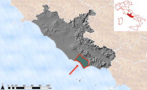
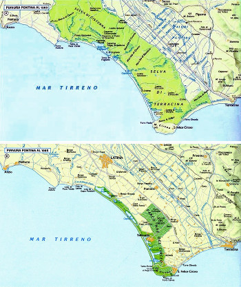
 Agro Pontino: then and now
The following images show the changes of Agro Pontino for over a hundred years. In 1894, when the map was completed, the lowland forest of Terracina extended over 11,000 hectares. In 2008 the lowland forest covered an area of only 3,200 hectares, inside the National Park of Circeo.

CAPTION: The Agro Pontino at the beginning of the century and as it appears today
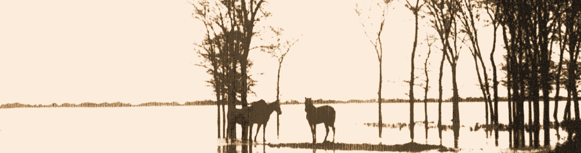
The lowland forestThe lowland forest is a tree community dominated by deciduous oaks (Quercus cerris, Q. frainetto, Q. robur), typical of coastal and subcoastal lowlands, often with very humid soils. When the water table rises to the surface,Q. robur and Fraxinus oxycarpa prevail. It once extended over the entire Padana plain and peninsular coasts, however land reclamation operations have reduced it to a few protected areas.
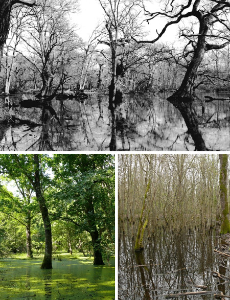
On the occasion of the extensive land reclamation works of the vast marshy plains completed between the late 20s and early 30s, a small section (approximately a quarter) of the woodlands of Terracina was neither cut down nor transformed into arable land, in order to keep a testimony of the past and maintain a wood reserve. Reclamation works were also carried out inside this part of the forest, albeit to a lesser extent, consisting of the opening of drainage canals, the partial filling of pools and cutting of the underwood. Consequently the flora, especially in marsh or hygrophilous areas underwent significant reduction, although it is difficult to say to what extent.
Here below a few (colour) images show an example of conservation of the Pontineforest inside the Circeo National Park, compared with a black and white image from the 30's.
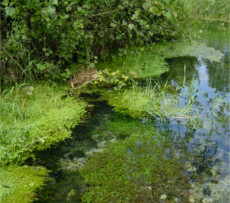
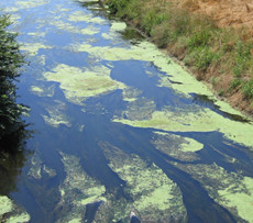
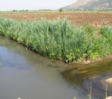
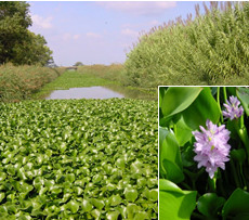
Current state of the canals of Agro Pontino:
|
Frasso – Terracina |
Canal in the Pontine Plain near via Appia |
Latina – Fosso Selcella |
Terracina - drainage canals |
|
|
|
|
| Clean waters: aquatic vegetation with Callitriche stagnalis Scop., Nasturtium officinale R. Br., Phragmites australis (Cav.) Trin. ex Steud. | Eutrophication and alteration of rivers and streams caused by man | Cladofora sp. and Cyanobacteria | Eichhornia crassipes (Mart.) Solmsan exotic invasive species |
Images of Agro Pontino thenand now
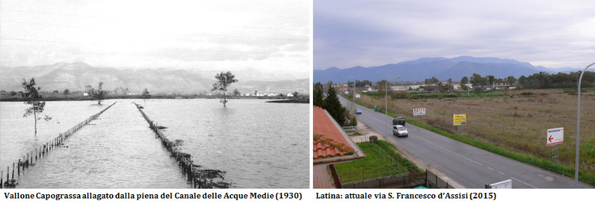 CAPTION: Vallone Capograssa flooded by Acque Alte canal (1930) Latina: San Francesco d’Assisi street in 2015
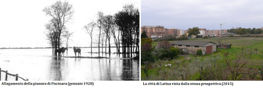 CAPTION: Flooded Piscinara plain (January 1928) Latina city from the same viewpoint (2015)
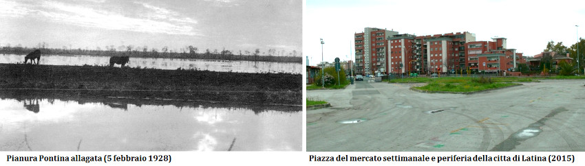 CAPTION: Flooded Pontine plain (5 February 1928)
Latina: Weekly marketplace square and outskirts of the city (2015)
CAPTION: Flooded Pontine plain (5 February 1928)
Latina: Weekly marketplace square and outskirts of the city (2015)
