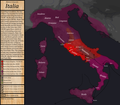
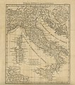
Category:Maps of Italy
Jump to navigation
Jump to search
Countries of Europe: Albania · Andorra · Armenia‡ · Austria · Azerbaijan‡ · Belarus · Belgium · Bosnia and Herzegovina · Bulgaria · Croatia · Cyprus‡ · Czech Republic · Denmark · Estonia · Finland · France · Georgia‡ · Germany · Greece · Hungary · Iceland · Ireland · Italy · Kazakhstan‡ · Latvia · Liechtenstein · Lithuania · Luxembourg · Malta · Moldova · Monaco · Montenegro · Netherlands · North Macedonia · Norway · Poland · Portugal · Romania · Russia‡ · San Marino · Serbia · Slovakia · Slovenia · Spain‡ · Sweden · Switzerland · Turkey‡ · Ukraine · United Kingdom · Vatican City
Specific status: Akrotiri and Dhekelia‡ · Faroe Islands · Gibraltar · Guernsey · Isle of Man · Jersey – Limited recognition: Abkhazia‡ · Republic of Artsakh‡ · Gagauzia · Kosovo · South Ossetia‡ · Transnistria · Turkish Republic of Northern Cyprus‡ · United Nations Buffer Zone in Cyprus‡
‡: partly located in Europe
Wikimedia category | |||
| Upload media | |||
| Instance of | Wikimedia category | ||
|---|---|---|---|
| Category combines topics | Italy, map | ||
 | |||
| |||
- See also maps needing categories in Category:Unidentified maps
Use the appropriate category for maps showing all or a large part of Italy. See subcategories for smaller areas:
| If the map shows | Category to use |
|---|---|
| Italy on a recently created map | Category:Maps of Italy or its subcategories |
| Italy on a map created more than 70 years ago | Category:Old maps of Italy or its subcategories |
| the history of Italy on a recently created map | Category:Maps of the history of Italy or its subcategories |
| the history of Italy on a map created more than 70 years ago | Category:Old maps of the history of Italy or its subcategories |
Subcategories
This category has the following 48 subcategories, out of 48 total.
!
*
+
A
B
C
D
E
F
G
H
I
L
N
O
P
S
T
W
Pages in category "Maps of Italy"
The following 2 pages are in this category, out of 2 total.
Media in category "Maps of Italy"
The following 200 files are in this category, out of 243 total.
(previous page) (next page)- 1789 of 'Italien ... mit 12 Städteplanen und 40 Ansichten in Stahlstich' (11024623344).jpg 2,432 × 1,664; 1.17 MB
- 1791 of 'Italien ... mit 12 Städteplanen und 40 Ansichten in Stahlstich' (11024948025).jpg 2,432 × 1,628; 1,005 KB
- 1807 of 'Italien ... mit 12 Städteplanen und 40 Ansichten in Stahlstich' (11025391775).jpg 1,554 × 2,441; 1.28 MB
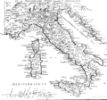
- 1936-04-05 Mille Miglia percorso.jpg 813 × 1,094; 79 KB
- 2018 Regions.png 800 × 1,030; 126 KB
- 34 of '(Italy and her Invaders, Vol. 1-4.)' (11217316876).jpg 2,831 × 2,235; 1.77 MB
- 77 of 'Napoléon et son temps ... Ouvrage illustré ... Neuvième mille' (11236496455).jpg 2,896 × 1,836; 1.55 MB
- Aas3 gemonese.jpg 1,648 × 1,120; 210 KB
- Aas3 sdan.jpg 1,044 × 816; 157 KB
- Activities of Ezzelino III da Romano.svg 1,051 × 535; 268 KB
- Administrative map of Italy showing regions, provinces and communes.png 1,632 × 2,112; 198 KB
- Administrative Regions of Italy.png 800 × 1,005; 175 KB
- Adost.png 3,507 × 2,480; 308 KB
- Adriatic Sea, 1911.png 449 × 433; 564 KB
- Aft.JPG 667 × 576; 56 KB
- Agilulf's Italy(JP).svg 588 × 702; 67 KB
- Aistulf's Italy(JP).svg 604 × 682; 68 KB
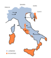
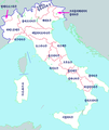
- Aistulf's Italy-en.png 531 × 600; 50 KB
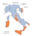
- Aistulf's Italy-zh.gif 531 × 600; 14 KB
- Aistulf's Italy-zh.svg 604 × 682; 38 KB
- Alia - mappa strada statale 50bisvar.svg 4,305 × 5,411; 1.47 MB
- Arcidiocesi e sedi-k.jpg 914 × 1,067; 154 KB
- Area metropolitana di Treviso.png 715 × 599; 115 KB
- Area SAR italia e zone MRSC.pdf 867 × 1,248; 1.97 MB
- Area SAR italia e zone MRSC.png 867 × 1,110; 655 KB
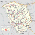
- Balmuccia.svg 565 × 744; 169 KB
- BigName.jpg 3,639 × 2,573; 381 KB
- Board Map PratoAllAlbero.jpg 5,152 × 3,864; 5.84 MB
- BtfPydi+.png 5,300 × 6,785; 1.04 MB
- Campania Province.png 1,056 × 816; 39 KB
- Campania Provinces ar.png 1,056 × 816; 25 KB
- Campania Provinces.png 1,056 × 816; 27 KB
- Carnia.jpg 2,873 × 1,721; 573 KB
- Castegnero variante sentiero N1(vesione partenza-frecce).jpg 1,285 × 806; 292 KB
- Central European Italy.png 662 × 783; 168 KB
- Circondari del Regno d'Italia 1.jpg 2,232 × 2,888; 1.44 MB
- Circondari del Regno d'Italia.jpg 2,232 × 2,888; 1.26 MB
- Codroipo.jpg 1,561 × 1,233; 240 KB
- Colonie italiane.jpg 1,556 × 2,008; 401 KB
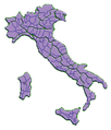
- Colori delle province italiane (2 marzo 2021).png 5,300 × 6,785; 2.56 MB
- Comuni frontalieri lombardia piemonte.png 5,147 × 4,004; 2.9 MB
- Comunita.bg.lc.svg 1,052 × 744; 1.92 MB
- Cosenza.png 201 × 251; 6 KB
- Costiera sorrentina.svg 1,052 × 744; 223 KB
- Costiera sorrentina.svg.svg 1,052 × 744; 224 KB
- D163- N° 450. Italie du Nord. - Liv3-Ch18.png 1,452 × 1,440; 159 KB
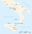
- D164- N° 451. Italie du Sud. - Liv3-Ch18.png 1,444 × 1,930; 201 KB
- Daily-deaths-italy-coverage-2020-04-12.svg 1,440 × 1,877; 290 KB
- Daily-deaths-italy-coverage-2020-04-16.svg 1,440 × 1,877; 290 KB
- Dambel map.svg 1,052 × 744; 2.18 MB
- Dimore rurali in Italia.svg 624 × 624; 2.21 MB
- Durezza acqua Italia.png 1,101 × 1,305; 54 KB
- Eatintime mappa Italia.jpg 1,200 × 848; 187 KB
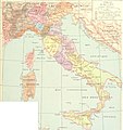
- EB1911 Italy - Map.jpg 1,602 × 2,275; 2.43 MB
- EB1911 Italy - Renaissance & Unification.jpg 1,582 × 1,130; 1.1 MB
- EB1911 Italy -Ancient - Joined 9.jpg 1,632 × 2,232; 2.27 MB
- Effigies Romae antiquae repraesentans Romam quadratam et muros Servii ac Aurelii.jpg 3,333 × 2,603; 3.29 MB
- Elba island in Italy map.jpg 954 × 1,198; 391 KB
- Entities for which Wikidata knows a street address in Italy, color-coded by entity type.png 1,920 × 1,053; 1.22 MB
- Entroterra Apulia Plinio.gif 1,587 × 865; 28 KB
- Eparhija-cela.png 1,332 × 1,790; 65 KB
- FLII Italy.png 898 × 882; 398 KB
- Fusioni di comuni in Italia.png 2,607 × 2,405; 588 KB
- Gegend zwischen Verona, Peschiera, und Mantova 01.jpg 5,681 × 7,210; 8.65 MB
- Gegend zwischen Verona, Peschiera, und Mantova 02.jpg 7,231 × 5,597; 10.04 MB
- Gegend zwischen Verona, Peschiera, und Mantova 03.jpg 7,236 × 5,605; 11.12 MB
- Gegend zwischen Verona, Peschiera, und Mantova 04.jpg 7,288 × 5,670; 10.27 MB
- Gemeinden Italien 2018.png 3,000 × 3,592; 2.93 MB
- Goten.png 300 × 328; 162 KB
- Gotik Backstein Italien.png 1,960 × 2,240; 6.46 MB
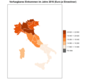
- Haushaltseinkommen pro Kopf nach Regionen 2016.png 1,886 × 1,754; 215 KB
- Hilfe gmt beispiel italien.png 1,062 × 1,140; 42 KB
- I. László hódításai.JPG 2,000 × 2,602; 314 KB
- Indice di corruzione sanità.png 500 × 630; 89 KB
- Insulo de la Rozoj mapo.jpg 299 × 376; 18 KB
- Istituti Zooprofilattici Sperimentali.png 5,300 × 6,785; 1.75 MB
- Italia - mappa autostada Nuova Romea.svg 4,305 × 5,411; 1.54 MB
- Italia - mappa strada statale 141.svg 4,305 × 5,411; 1.47 MB
- Italia - mappa strada statale 245.svg 4,305 × 5,411; 1.47 MB
- Italia - mappa strada statale 246.svg 4,305 × 5,411; 1.46 MB
- Italia - mappa strada statale 247.svg 4,305 × 5,411; 1.47 MB
- Italia - mappa strada statale 248.svg 4,305 × 5,411; 1.47 MB
- Italia - mappa strada statale 250.svg 4,305 × 5,411; 1.47 MB
- Italia - mappa strada statale 251.svg 4,305 × 5,411; 1.48 MB
- Italia - mappa strada statale 307.svg 4,305 × 5,411; 1.46 MB
- Italia - mappa strada statale 348.svg 4,305 × 5,411; 1.47 MB
- Italia - mappa strada statale 422.svg 4,305 × 5,411; 1.48 MB
- Italia - mappa strada statale 500.svg 4,305 × 5,411; 1.46 MB
- Italia - mappa strada statale 515.svg 4,305 × 5,411; 1.47 MB
- Italia - mappa strada statale 516.svg 4,305 × 5,411; 1.49 MB
- Italia - mappa strada statale 635.svg 4,305 × 5,411; 1.48 MB
- Italia - mappa strada statale 667.svg 4,305 × 5,411; 1.48 MB
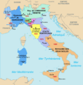
- Italia 1843-fr.png 885 × 909; 70 KB
- Italia della scienza.jpg 622 × 778; 370 KB
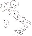
- Italia per aree num.jpg 1,576 × 1,776; 180 KB
- Italia WLM mappa macroregioni.svg 1,200 × 1,498; 120 KB
- Italia-Province 2.png 235 × 275; 20 KB
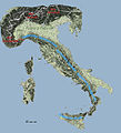
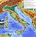
- Italiafisica2.jpg 4,968 × 5,464; 5.72 MB
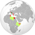
- Italian empire 1942.png 596 × 600; 168 KB
- ITALIAN PROVINCES WITH METROPOLITAN CITIES.png 1,660 × 2,007; 137 KB
- ITALIAN PROVINCES.png 1,660 × 1,980; 115 KB
- Italian Provinces.png 1,660 × 1,980; 80 KB
- Italian Regions by coalition at the end of 2019.svg 800 × 1,030; 238 KB
- Italian regions provinces German.svg 1,200 × 1,500; 1.66 MB
- Italiana -map.png 2,000 × 2,380; 1.05 MB
- Italien-Frauen-WM-Platzierungen.PNG 1,425 × 625; 38 KB
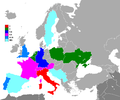
- Italienische-EM-Platzierungen.PNG 1,200 × 1,000; 69 KB
- Italy (2674791365).jpg 2,000 × 1,476; 1.98 MB
- Italy Base Map.png 2,370 × 2,812; 406 KB
- Italy Blue.png 466 × 521; 6 KB
- Italy BW1.png 2,000 × 2,358; 3.06 MB
- Italy colourable Provinces as of 2019-A4.svg 744 × 1,052; 1.5 MB
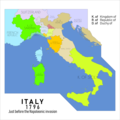
- Italy in 1796.png 2,750 × 2,750; 565 KB
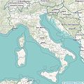
- Italy Map OpenStreetMap.jpg 833 × 831; 280 KB
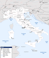
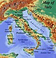
- Italy Map.jpg 1,300 × 1,339; 421 KB
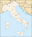
- Italy Reg.png 300 × 350; 11 KB
- Italy topographic map-blank relief only.svg 1,759 × 2,167; 1.25 MB
- Italy without Liguria.svg 735 × 867; 94 KB
- Italy wordmark.svg 2,500 × 3,200; 13 KB
- Karte Stubaier Alpen.png 3,354 × 3,366; 3.21 MB
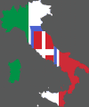
- Kingdom of italy flag map.gif 547 × 657; 26 KB
- Középitália a Jirka-féle könyvből.jpg 1,346 × 1,110; 431 KB
- Latin for beginners (1911) (14769844142).jpg 2,588 × 3,884; 1.41 MB
- Lavandula latifolia - Distribuzione.png 1,075 × 682; 323 KB
- Le réseau des voies romaines dans l'ancienne Vénétie.png 850 × 588; 262 KB
- Lidi della Riviera Romagnola.svg 1,052 × 744; 1.02 MB
- Lunigiana (1).svg 860 × 800; 334 KB
- Map of comune of Lusiana Conco.png 1,934 × 3,000; 796 KB
- Map of Italia meridionale Campania-Puglia-Basilicata.svg 512 × 343; 2.39 MB
- Map of Occitan Valleys - Italy - according to Law 482-1999 declarations.svg 622 × 784; 11.67 MB
- Mapa da Itália (OCHA).svg 254 × 254; 1.06 MB
- MapChart Map (131.png 5,300 × 6,785; 1.99 MB
- MapChart Map.png 5,300 × 6,785; 2 MB
- Mappa aree interne italia.jpg 2,481 × 3,325; 2.35 MB
- Mappa aree pilota SNAI.jpg 2,481 × 3,325; 1.69 MB
- Mappa della Lake Como Poetry Way in alta risoluzione.pdf 3,891 × 2,881, 2 pages; 33.87 MB
- Mappa Ferrovia Faenza-Firenze.jpg 968 × 1,007; 1.03 MB
- Mappa Provincia IT-VC tutti i comuni.svg 744 × 1,052; 1.15 MB
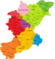
- Mappa provincie BG CO LC LO MB MI NO PV VA.jpg 493 × 365; 136 KB
- Mappa regioni con movimenti indipendentisti.png 480 × 600; 75 KB
- Mappa unione di comuni della Vallata del Foro.png 1,024 × 1,340; 164 KB
- Mappa Vercurago.svg 900 × 1,290; 37 KB
- Mappa-dell'Italia.jpg 2,021 × 2,089; 4.81 MB
- Mappa-unione-Laga.png 2,841 × 2,268; 387 KB
- Mappa-unione-Vibrata.png 2,841 × 2,268; 385 KB
- Marche italiane nel X secolo.jpg 1,342 × 896; 231 KB
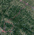
- Memorie della Reale accademia delle scienze di Torino (1911) (14773796262).jpg 1,854 × 1,228; 777 KB
- Mozartinitalymap.jpg 1,559 × 1,899; 427 KB
- Municipalities of Italy.svg 895 × 1,038; 87.66 MB
- Ober-Italien 1859.jpg 8,131 × 4,726; 15.83 MB
- Ober-Italien.jpg 8,112 × 4,946; 15.89 MB
- Percorso Palio di Legnano.svg 1,434 × 1,172; 1.69 MB
- Pianta delle 500 moggia dell’Arenosola.jpg 1,067 × 787; 166 KB
- Pisan Republic.png 5,016 × 2,448; 10.77 MB
- Plan Topographique De La Campagne De Rome.jpg 11,012 × 7,530; 19.05 MB
- Presidenza delle Regioni italiane.png 1,386 × 1,739; 477 KB
- Presidi INRCA.jpg 647 × 426; 86 KB
- Provincia di Belluno.png 4,096 × 4,328; 1.12 MB
- Puertos de Italia.png 2,496 × 2,496; 483 KB
- Regio-II-Plinio-BN.tif 2,985 × 2,245; 821 KB
- Regional Composition of the Italian Council of Ministers (Conte II Cabinet 2019).svg 2,254 × 2,876; 909 KB
- Regional Composition of the Italian Council of Ministers (Draghi Cabinet 2021) - vi.svg 1,200 × 1,500; 439 KB
- Regional Composition of the Italian Council of Ministers (Draghi Cabinet 2021).svg 1,200 × 1,500; 439 KB
- Regione geografica italiana.png 989 × 1,184; 1.7 MB
- Regionen Italiens.PNG 1,101 × 1,305; 265 KB
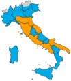
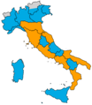
- Regioni coalizioni prima delle regionali 2020 20-21 settembre.png 1,887 × 2,167; 63 KB
- Regioni coalizioni prima delle regionali 2020 26 gennaio.png 1,887 × 2,167; 63 KB
- Regioni coalizioni prima delle regionali 2020.png 1,887 × 2,167; 63 KB
- Regioni crest.png 300 × 400; 15 KB
- Regioni Italia - Presidenti 2018.png 800 × 1,004; 245 KB
- Regioni italiane - Presidenti 2018.png 800 × 1,004; 253 KB
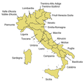
- Regions of Italy with official names.png 1,108 × 1,097; 115 KB
- Reka-Timavo karta.jpg 1,106 × 785; 102 KB
- Repubblica Italiana vs Regione geografica Italiana (nord) (V2).jpg 1,536 × 1,536; 151 KB
- Repubblica Italiana vs Regione geografica Italiana (nord).jpg 1,536 × 1,536; 150 KB
- Ripartizione geografica dei membri del Consiglio dei Ministri (Governo Draghi 2021).svg 1,200 × 1,500; 439 KB
- Riva Po.svg 1,052 × 744; 96 KB
- Roman Conquests - Italia.png 1,936 × 1,696; 2.05 MB
- Romancoloniae2.jpg 208 × 234; 30 KB
- Salerno pos Agro.GIF 463 × 375; 10 KB
- San Michele Adige.svg 1,052 × 744; 2.18 MB
- Sanzeno.svg 1,052 × 744; 2.18 MB
- Sentinel-3A takes Earth’s temperature ESA369237.jpg 2,756 × 1,656; 810 KB


%27_(11232867725).5f)
.5fd9.delay)
.5fdb.delay)
.5fdd.delaye)



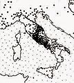
%27_(11217316876).jpg/120px-34_of_%27(Italy_and_her_Invaders%2c_Vol._1-4.)%27_(11217316876).jpg)


.jpg)
_oszt%c3%a1ly_sz%c3%a1mara_..._t%c3%a9rk%c3%a9ppel%27_()


.svg/100px-Agilulf%27s_Italy(JP).svg.png)
.svg/106px-Aistulf%27s_Italy(JP).svg.png)
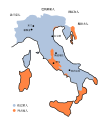

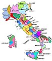
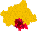


.jpg/120px-Castegnero_variante_sentiero_N1(vesione_partenza-frecce).jpg)
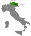


.png/94px-Colori_delle_province_italiane_(2_marzo_2021).png)






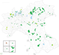


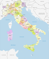
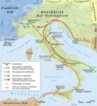
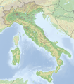









.jpg/120px-Italy_(2674791365).jpg)





_(14769844142).jpg/80px-Latin_for_beginners_(1911)_(14769844142).jpg)


.svg/120px-Lunigiana_(1).svg.png)

.svg.png)


.svg/120px-Mapa_da_It%c3%a1lia_(OCHA).svg.png)






_(14773796262).jpg)



.svg.png)
.svg.png)
_-_vi.svg.6131.delay)
.svg.png)



_(V2).jpg/120px-Repubblica_Italiana_vs_Regione_geografica_Italiana_(nord)_(V2).jpg)
.jpg/120px-Repubblica_Italiana_vs_Regione_geografica_Italiana_(nord).jpg)
.svg.614d.delay)

